Antarctica - Geography
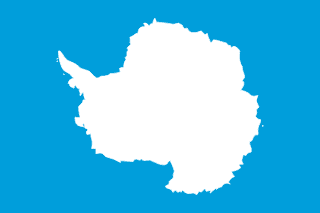
Here, let us take a look at the Geography of Antarctica. The coldest, windiest, highest (on average), and driest continent; during the summer, more solar radiation reaches the surface at the South Pole than is received at the equator in an equivalent period
mostly uninhabitable, 99% of the land area is covered by the Antarctic ice sheet, the largest single mass of ice on Earth; it covers an area of 14 million sq km (5.4 million sq mi) and contains 26.5 million cu km (6.4 million cu mi) of ice (almost 62% of the world's fresh water). Mother's mean age at first birth is (), whereas, the Maternal mortality ratio is
Geographical data of Antarctica
| Location | continent mostly south of the Antarctic Circle |
|---|---|
| Geographic coordinates | 90 00 S, 0 00 E |
| Map references | Antarctic Region |
| Tarrain | about 99% thick continental ice sheet and 1% barren rock, with average elevations between 2,000 and 4,000 m; mountain ranges up to nearly 5,000 m; ice-free coastal areas include parts of southern Victoria Land, Wilkes Land, the Antarctic Peninsula area, and parts of Ross Island on McMurdo Sound; glaciers form ice shelves along about half of the coastline, and floating ice shelves constitute 11% of the area of the continent |
| Natural Resources | iron ore, chromium, copper, gold, nickel, platinum and other minerals, and coal and hydrocarbons have been found in small noncommercial quantities; mineral exploitation except for scientific research is banned by the Environmental Protocol to the Antarctic Treaty; krill, icefish, toothfish, and crab have been taken by commercial fisheries, which are managed through the Commission for the Conservation of Antarctic Marine Living Resources (CCAMLR) |
| Natural Hazards | katabatic (gravity-driven) winds blow coastward from the high interior; frequent blizzards form near the foot of the plateau; cyclonic storms form over the ocean and move clockwise along the coast; large icebergs may calve from ice shelf volcanism: volcanic activity on Deception Island and isolated areas of West Antarctica; other seismic activity rare and weak |
| Irrigated Land | |
| Major rivers (by length in km) | |
| Major aquifers | |
| Land Boundaries | |
| Border Countries | |
| Coastline | 17,968 km |
| Climate | the coldest, windiest, and driest continent on Earth; severe low temperatures vary with latitude, elevation, and distance from the ocean; East Antarctica is colder than West Antarctica because of its higher elevation; Antarctic Peninsula has the most moderate climate; higher temperatures occur in January along the coast and average slightly below freezing; summers characterized by continuous daylight, while winters bring continuous darkness; persistent high pressure over the interior brings dry, subsiding air that results in very little cloud cover |
| Area | |
| Total Area | |
| Land Area | 14.2 million sq km (285,000 sq km ice-free, 13.915 million sq km ice-covered) (est.) |
| Water Area | |
| comparative Area | slightly less than 1.5 times the size of the US |
| Maritime Claims | |
| Elevations | |
| Highest point | Vinson Massif 4,892 m |
| Lowest point | Denman Glacier more than -3,500 m (-11,500 ft) below sea level |
| Mean elevation | 2,300 m |
| Land Use | |
| Agricultural land | 0% (2018 est.) |
Population Distribution
People and Society
In Antarctica, the different Ethnic groups are such that we have:
| Population | no permanent inhabitants, but staff is present at year-round and summer-only research stations note: 56 countries have signed the 1959 Antarctic Treaty; 30 of those operate a number of seasonal-only (summer) and year-round research stations on the continent and its nearby islands; the population varies from approximately 5,000 in summer to 1,100 in winter, with about 1,000 support personnel on ships nearby as of 2024, peak summer (December-February) maximum capacity in scientific stations - 4,713 total; Argentina 425, Australia 238, Belarus 15, Belgium 55, Brazil 64, Bulgaria 25, Chile 375, China 164, Czechia 32, Ecuador 35, Finland 16, France 136, France and Italy jointly 70, Germany 60, India 72, Italy 150, Japan 130, South Korea 158, New Zealand 85, Norway 60, Peru 30, Poland 41, Russia 211, South Africa 80, Spain 79, Sweden 16, Ukraine 15, United Kingdom 315, United States 1,495 , Uruguay 66 (2024) winter (June-August) maximum capacity in scientific stations - 1,056 total; Argentina 221, Australia 52, Brazil 15, Chile 114, China 32, France 24, France and Italy jointly 13, Germany 9, India 48, Japan 40, Netherlands 10, South Korea 25, NZ 11, Norway 7, Poland 16, Russia 125, South Africa 15, Ukraine 12, UK 44, US 215, Uruguay 8 (2024) |
|---|---|
| Pop growth rate | |
| Birth rate | |
| Death rate | |
| Health expenditure | |
| Physicians Density | |
| Hospital bed Density | |
| Total fertility rate | |
| Gross reproduction rate | |
| Contraceptive prevalence rate | |
| Est married women (ages 15-49) | |
| Literacy | |
| Education expenditures | |
| Net Migration rate | |
| Nationality | | |
| Languages | |
| Religions | |
| Major urban areas (Pop) | . |
Demographic profile
All Important Facts about Antarctica
Want to know more about Antarctica? Check all different factbooks for Antarctica below.
-
 Antarctica Factbook
-
 The Economy of Antarctica
-
 Learn about the Government of Antarctica
-
 Communication in Antarctica
-
 Popular Universities in Antarctica
-
 Enerny in Antarctica
-
 Transport in Antarctica
-
 The Geography and society of Antarctica
-
 The Environment of Antarctica
-
 Military and security in Antarctica