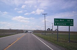
Nevada (pronounced nah-VAY-da) is a small village in Wyandot County in Northwest Ohio.
Get in
[edit]By car
[edit]
- U.S. Route 30, Nevada, Ohio can be accessed by U.S. Route 30, about a half mile to the south of Nevada which provides connection to Fort Wayne, Lima, and Upper Sandusky to the west, Bucyrus, Mansfield, and Canton to the east.
- Ohio State Route 231, goes through Nevada, Ohio. It's the main route to Nevada from U.S. Route 30 which is located to the south of town.
Get around
[edit]There is no public transportation in Nevada, Ohio. It is located in a rural area, driving is easy and pleasurable.
See
[edit]Do
[edit]- 1 Nevada Park, Balliet St.
Buy
[edit]The nearest large retailers are in Ontario and Mansfield.
Eat
[edit]- B & L Pizza, 107 South Main Street, ☏ +1 740 482-2882. Nevada, Ohio 44849,
- Cruisers Drive Thru, 210 North Main Street, ☏ +1 740 482-0040.
- Buck's Place, 202 North Main Street, ☏ +1 740 482-2763.
- Gail's, 113 South Main Street, ☏ +1 740 482-2222.
- PoMos Country Cafe and Pizza Emporium, 113 South Main Street, ☏ +1 740 482-2265.
- Shabby M's At Fingers Corner, 1006 County Road, ☏ +1 740 482-1600. 330, Nevada
Drink
[edit]- Buck's Place, 202 North Main Street, ☏ +1 740 482-2763.
- White Shutter Wine & Brewery, 3794 County Highway 56.
Sleep
[edit]- Comfort Inn Upper Sandusky, 105 Comfort Dr, ☏ +1 419 294-3891, fax: +1 419 294-2540. Upper Sandusky. Hotel is located about 10 minutes away, take U.S. Route 30 west to the Upper Sandusky/County Highway 330/E. Wyandot Ave. exit, turn left on East Wyandot Avenue, hotel is on the right on Comfort Drive.
- Foxfire Campground, 3699 Crawford-Wyandot Rd.
Connect
[edit]- Nevada Post Office, 115 N Main St, ☏ +1 740 482-2020.
Go next
[edit]- Upper Sandusky is about 15 minutes west on U.S. Route 30.
- Bucyrus is about 15 minutes east on U.S. Route 30.
- Tiffin is about 35 minutes north on Ohio State Route 231.
- Marion is about 30 minutes south on Ohio State Route 231 and south on U.S. Route 23.
- Ontario is about 30 minutes east on U.S. Route 30.
- Mansfield is about 40 minutes east on U.S. Route 30.
- Columbus is about 1 hour and 20 minutes south on Ohio State Route 231 and south on U.S. Route 23.
| Routes through Nevada |
| Lima via |
W |
→ Bucyrus → Mansfield |

