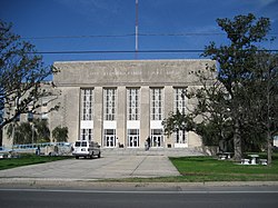
Saint Bernard Parish is a community of 47,000 people (2018) in Louisiana, at the southern edge of the Greater New Orleans region. The chief historical attraction in St. Bernard Parish is the Chalmette Battlefield (part of Jean Lafitte National Historical Park and Preserve), at which the Battle of New Orleans took place on January 8, 1815, during the War of 1812.
Cities
[edit]- 1 Arabi , the town between New Orleans' Lower 9th and Chalmette.
- 2 Chalmette — the parish seat and largest city
- 3 Violet
Understand
[edit]A Louisiana "parish" is the equivalent of a "county" in other states.
The Parish, or "Da Parish" as locals often refer to it, borders the east bank of the Missisisppi River. To the west and north is the city of New Orleans. Downriver to the south is the east bank of Plaquemines Parish.
Saint Bernard was even more devastated than New Orleans during Hurricane Katrina in 2005 — though as many locals can tell you, the majority of the damage wasn't from the Hurricane per se (detailed below). The parish's population fell from 67,000 in 2000 to 36,000 in 2010. Recovery and rebuilding are ongoing.
There are no incorporated communities in St. Bernard, so the names of towns and places are sometimes more a matter of what locals traditionally call a location than any legally set boundaries. (Just a heads up not to worry, for example, if that little restaurant you came across in what your road maps shows as the town of "Violet" has "Chalmette" printed on the menu and the mailing address listed as "Meraux".)
St. Bernard Parish contains a large community of Spanish descent. Sometimes referred to informally as "Spanish Cajuns", the Isleños are descended from Canary Islanders. This linguistically isolated group eventually developed its own dialect.
Background
[edit]
The main roots of St. Bernard go back to the French and Spanish colonial era; the majority of the population still have Spanish or French family names. One notable ethnic group is the Isleño population; a large group of people from the Spanish Canary Islands, known as "Isleños", settled in the parish in the second half of the 1700s. While Louisiana passed to the United States with the Louisiana Purchase in 1803, the Isleño Spanish dialect was still common to hear in some smaller towns and rural areas well into the 20th century. While some locals keep the traditional Isleño songs and folklore alive, English is now universally understood here -- though locals may speak it with an accent unlike that usually found in the U.S.'s deep south.
In 1927 the Mississippi River was at historically high levels, and burst its banks many places further up river. The city of New Orleans's levees were right at the edge of being overtopped. A group of New Orleans bankers hatched a plan to blow up a levee in St. Bernard in order to relieve pressure on the levees of New Orleans. This was done, flooding much of the Parish. The New Orleans bankers had promised generous compensation for the people of St. Bernard beforehand, but delivered very little (many people affected got nothing at all). Local resentment of New Orleans continued for generations.
In 1965, much of the parish was flooded when Hurricane Betsy hit Louisiana. Many locals blamed much of the flooding on a then new navigation canal, the Mississippi River – Gulf Outlet Canal or MRGO, commonly called "Mister Go", which they said funneled in storm surge from the Gulf of Mexico right into the populated area, acting as a "Hurricane Highway". The Army Corps of Engineers denied the MRGO had any link to the flooding.
In 2005, during Hurricane Katrina, walls of floodwaters several meters high crashed through the entire parish, flooding on a scope that dwarfed previous disasters. A series of independent investigations afterwards eventually made clear that the parish locals had been right all along: MRGO indeed served as a "superhighway for storm surge", making MRGO, along with a series of badly misdesigned levees, the cause of most of the flooding in Greater New Orleans in 2005. The MRGO Canal was deactivated, and a barrier closing it off completed in 2009. A system of much improved levees and floodwalls is nearing completion. However the environmental damage that had already been caused by the engineering mistake of MRGO is estimated to cost many billions of dollars, and there is no plan nor suggested funding to repair it.
As fishing has long been an important industry here, the BP Deepwater Horizon Oil Spill in 2010 dealt another blow to the parish.
Get in
[edit]Unless you're downriver in Plaquemines Parish, the only land routes into Saint Bernard are through New Orleans. From Interstate 10 in Eastern New Orleans take I-510 south; after passing through a bit of marshland this will turn into Paris Road and lead you right in the center of Chalmette. The other roads in from New Orleans are via the Lower 9th Ward; cross the Industrial Canal on either St. Claude Avenue (which will become St. Bernard Highway after passing the Parish line) or Claiborne Avenue (which will become Judge Perez Drive on the St. Bernard side of the line). There is also a vehicle ferry from the West Bank of the Mississippi River, from the lower coast of Algiers to Chalmette.
Get around
[edit]Automobile is the most practical way to get around.
By public transit, St. Bernard is linked to New Orleans by New Orleans Regional Transit bus line 88, "St. Claude/Jackson Barracks", which runs from Canal & Rampart street in New Orleans to St. Claude at Aycock Street in Arabi.
This connects with the St. Bernard Urban Rapid Transit (SBURT) transit route at St. Claude & Mehele, running down Judge Perez Highway from Arabi to the town of Poydras, Weekdays daytime only. [1] [formerly dead link]
See
[edit]- Chalmette. St. Bernard's largest city also includes the site of the "Battle of New Orleans" from the "War of 1812" and the ruins of the De la Ronde Plantation. Other than these historic sites there is little to "sight see" in mostly modern Chalmette, but it is the Parish's center of commerce and dining. Details in the Chalmette article.
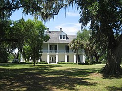
- Terre aux Bouefs region. Highways 46 and 300 wind into the eastern part of the Parish historically known as the "land of oxen" or "Terre aux Bouefs". The two highways run roughly parallel through the region from the town of Poydras on the Riverfront to the area around the village of Regio to the east, with small roads and streets linking the two highways. A series of small communities dot the routes. 46 is the quicker more modern highway, but 300 aka Bayou Road is more scenic with pretty bayou views and historic sites, including the old St. Bernard Church and Cemetery [formerly dead link] , Kenilworth Plantation House, and the Isleño Cultural Center. As of 2012 a bridge on 300 is out at the town of Toca, where you have to drive half a mile over to 46 and then back again on the other side-- the historic scenery on the old road is worth taking this route despite the detour.
- Delacroix Island Some think it is debatable as to if the town of Delacroix is actually an "island"; it's an inland town in an area surrounded by swamps and bayous. It was only accessible by boat until the 1930s when the WPA built a long road through the wetlands to here; it's at the far end highway 300 south of Regio. Sometimes called "the end of the world". Though almost wiped out by Katrina, the long famous fishing community of Delacroix is back.
- Shell Beach is a fishing and boating community at the end of Highway 46. If you go out on a boat from here, try to swing by the ruins of historic old Fort Proctor, no longer accessible from land.
Do
[edit]- St. Bernard Seafood & Farmers' Market Every Saturday 8AM-1PM, 409 Aycock Street, Arabi.
- Isleños Fiesta is held on a weekend each March. Music, food, activities and exhibits celebrating St. Bernard's Canary Island Spanish heritage. At the Los Isleños Heritage Museum grounds 1345 Bayou Rd (Route 300 in St. Bernard) [2] [dead link]
Buy
[edit]Eat
[edit]Several restaurant options listed in the Chalmette article (including some in neighboring Meraux). Some more restaurants and cafes are scattered around other communities. Seafood and po-boy shops are the most popular. The Parish is more of a down-home eats than a haute cuisine place.
Drink
[edit]- Chalmette is pretty much the center for drinking establishments in St. Bernard. There are a fair number of bars and frozen daiquiri places along the main routes in the more urbanized area from Arabi to Violet, but much fewer in the further east parts of the Parish.
Stay safe
[edit]Connect
[edit]Area code is 504, same as in New Orleans.
Go next
[edit]

