Papua New Guinea - Geography
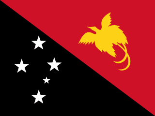
Here, let us take a look at the Geography of Papua New Guinea. note 1: shares island of New Guinea with Indonesia; highlands that trend from east to west break up New Guinea into diverse ecoregions; one of world's largest swamps lies along the southwest coast
note 2: Papua New Guinea is one of the countries along the Ring of Fire, which is a belt bordering the Pacific Ocean that contains about 75% of the world's volcanoes and up to 90% of the world's earthquakes. Mother's mean age at first birth is 21.9 years (2016/18) (Note: data represents median age a first birth among women 25-49), whereas, the Maternal mortality ratio is 189 deaths/100,000 live births (2023 est.)
Geographical data of Papua New Guinea
| Location | Oceania, group of islands including the eastern half of the island of New Guinea between the Coral Sea and the South Pacific Ocean, east of Indonesia |
|---|---|
| Geographic coordinates | 6 00 S, 147 00 E |
| Map references | Oceania |
| Tarrain | mostly mountains with coastal lowlands and rolling foothills |
| Natural Resources | gold, copper, silver, natural gas, timber, oil, fisheries |
| Natural Hazards | active volcanism; frequent and sometimes severe earthquakes; mud slides; tsunamis volcanism: severe volcanic activity; Ulawun (2,334 m), one of Papua New Guinea's potentially most dangerous volcanoes, has been deemed a Decade Volcano by the International Association of Volcanology and Chemistry of the Earth's Interior, worthy of study due to its explosive history and close proximity to human populations; Rabaul (688 m) destroyed the city of Rabaul in 1937 and 1994; Lamington erupted in 1951, killing 3,000 people; Manam's 2004 eruption forced the island's abandonment; other historically active volcanoes include Bam, Bagana, Garbuna, Karkar, Langila, Lolobau, Long Island, Pago, St. Andrew Strait, Victory, and Waiowa; see note 2 under "Geography - note" |
| Irrigated Land | 0 sq km (2022) |
| Major rivers (by length in km) | Sepik river source and mouth (shared with Indonesia) - 1,126 km; Fly river source and mouth (shared with Indonesia) - 1,050 km |
| Major aquifers | |
| Land Boundaries | 824 km |
| Border Countries | Indonesia 824 km |
| Coastline | 5,152 km |
| Climate | tropical; northwest monsoon (December to March), southeast monsoon (May to October); slight seasonal temperature variation |
| Area | |
| Total Area | |
| Land Area | 452,860 sq km |
| Water Area | 9,980 sq km |
| comparative Area | slightly larger than California |
| Maritime Claims | |
| Territorial sea | 12 nm |
| Continental shelf | 200-m depth or to the depth of exploitation |
| Exclusive fishing zone | 200 nm |
| Elevations | |
| Highest point | Mount Wilhelm 4,509 m |
| Lowest point | Pacific Ocean 0 m |
| Mean elevation | 667 m |
| Land Use | |
| Agricultural land | 3.1% (2023 est.) |
| Agricultural land: arable land | arable land: 0.7% (2023 est.) |
| Agricultural land: permanent crops | permanent crops: 2% (2023 est.) |
| Agricultural land: permanent pasture | permanent pasture: 0.4% (2023 est.) |
| Forest | 75.2% (2023 est.) |
| Other | 21.7% (2023 est.) |
Population Distribution
Population concentrated in the highlands and eastern coastal areas on the island of New Guinea; predominantly a rural distribution with only about one fifth of the population residing in urban areas
People and Society
In Papua New Guinea, the different Ethnic groups are such that we have: Melanesian, Papuan, Negrito, Micronesian, Polynesian
| Population | |
|---|---|
| Pop growth rate | 2.22% (2025 est.) |
| Birth rate | 27.57 births/1,000 population (2025 est.) |
| Death rate | 5.36 deaths/1,000 population (2025 est.) |
| Health expenditure | |
| Physicians Density | |
| Hospital bed Density | 0.2 beds/1,000 population (2019 est.) |
| Total fertility rate | 3.72 children born/woman (2025 est.) |
| Gross reproduction rate | 1.82 (2025 est.) |
| Contraceptive prevalence rate | |
| Est married women (ages 15-49) | 66.9% (2018 est.) |
| Literacy | |
| Education expenditures | |
| Net Migration rate | 0 migrant(s)/1,000 population (2025 est.) |
| Nationality | Papua New Guinean | Papua New Guinean(s) |
| Languages | Tok Pisin (official), English (official), Hiri Motu (official), some 839 living indigenous languages are spoken (about 12% of the world's total) |
| Religions | Protestant 64.3% (Evangelical Lutheran 18.4%, Seventh Day Adventist 12.9%, Pentecostal 10.4%, United Church 10.3%, Evangelical Alliance 5.9%, Anglican 3.2%, Baptist 2.8%, Salvation Army 0.4%), Roman Catholic 26%, other Christian 5.3%, non-Christian 1.4%, unspecified 3.1% (2011 est.) |
| Age Structure | |
| 0-14 years | 37.1% (male 1,902,272/female 1,825,471) |
| 15-64 years | 58.9% (male 2,991,479/female 2,923,410) |
| 65 years and over | 4% (2024 est.) (male 198,511/female 205,090) |
| Dependency Ratios | |
| Total dependency ratio | 69.4 (2025 est.) |
| Youth dependency ratio | 62.4 (2025 est.) |
| Elderly dependency ratio | 7 (2025 est.) |
| Potential support ratio | 14.2 (2025 est.) |
| Median Age | |
| Total | 21.9 years (2025 est.) |
| Male | 21.6 years |
| Female | 21.9 years |
| Urbanization | |
| Urban population | 13.7% of total population (2023) |
| Rate of urbanization | 2.91% annual rate of change (2020-25 est.) |
| Major urban areas (Pop) | 410,000 PORT MORESBY (capital) (2023). |
| Sex Ratio | |
| At birth | 1.05 male(s)/female |
| 0-14 years | 1.04 male(s)/female |
| 15-64 years | 1.02 male(s)/female |
| 65 years and over | 0.97 male(s)/female |
| Total population | 1.03 male(s)/female (2024 est.) |
| Infant Motality | |
| Total | 31.3 deaths/1,000 live births (2025 est.) |
| Male | 35.3 deaths/1,000 live births |
| Female | 28.6 deaths/1,000 live births |
| Life Expectancy at birth | |
| Total population | 70.1 years (2024 est.) |
| Male | 68.3 years |
| Female | 71.9 years |
| Drinking Water Sources | |
| Improved: urban | urban: 86.9% of population (2022 est.) |
| Improved: rural | rural: 44.5% of population (2022 est.) |
| Improved: total | total: 50.2% of population (2022 est.) |
| Unimproved: urban | urban: 13.1% of population (2022 est.) |
| Unimproved: rural | rural: 55.5% of population (2022 est.) |
| Unimproved: total | total: 49.8% of population (2022 est.) |
| Sanitation facility acess | |
| Improved: urban | urban: 57.8% of population (2022 est.) |
| Improved: rural | rural: 18.2% of population (2022 est.) |
| Improved: total | total: 23.6% of population (2022 est.) |
| Unimproved: urban | urban: 42.2% of population (2022 est.) |
| Unimproved: rural | rural: 81.8% of population (2022 est.) |
| Unimproved: total | total: 76.4% of population (2022 est.) |
| Alcohol consumption per capita | |
| Total | 1.26 liters of pure alcohol (2019 est.) |
| Beer | 0.6 liters of pure alcohol (2019 est.) |
| Wine | 0.06 liters of pure alcohol (2019 est.) |
| Spirits | 0.6 liters of pure alcohol (2019 est.) |
| Other alcohols | 0 liters of pure alcohol (2019 est.) |
| Tobacco use | |
| Total | 38.9% (2025 est.) |
| Male | 53.4% (2025 est.) |
| Female | 23.8% (2025 est.) |
| Child marriage | |
| Women married by age 15 | 8% (2018) |
| Women married by age 18 | 27.3% (2018) |
| Men married by age 18 | 3.7% (2018) |
Demographic profile
All Important Facts about Papua New Guinea
Want to know more about Papua New Guinea? Check all different factbooks for Papua New Guinea below.
-
 Papua New Guinea Factbook
-
 The Economy of Papua New Guinea
-
 Learn about the Government of Papua New Guinea
-
 Communication in Papua New Guinea
-
 Popular Universities in Papua New Guinea
-
 Enerny in Papua New Guinea
-
 Transport in Papua New Guinea
-
 The Geography and society of Papua New Guinea
-
 The Environment of Papua New Guinea
-
 Military and security in Papua New Guinea