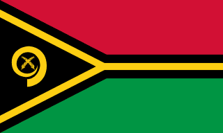
Vanuatu - Geography

Here, let us take a look at the Geography of Vanuatu. A Y-shaped chain of four main islands and 80 smaller islands; several of the islands have active volcanoes, including several underwater volcanoes. Mother's mean age at first birth is (), whereas, the Maternal mortality ratio is 100 deaths/100,000 live births (2023 est.)
Geographical data of Vanuatu
| Location | Oceania, group of islands in the South Pacific Ocean, about three-quarters of the way from Hawaii to Australia |
|---|---|
| Geographic coordinates | 16 00 S, 167 00 E |
| Map references | Oceania |
| Tarrain | mostly mountainous islands of volcanic origin; narrow coastal plains |
| Natural Resources | manganese, hardwood forests, fish |
| Natural Hazards | tropical cyclones (January to April); volcanic activity; volcanism also causes minor earthquakes; tsunamis volcanism: significant volcanic activity with multiple eruptions in recent years; Yasur (361 m), one of the world's most active volcanoes, has experienced continuous activity in recent centuries; other historically active volcanoes include Aoba, Ambrym, Epi, Gaua, Kuwae, Lopevi, Suretamatai, and Traitor's Head |
| Irrigated Land | 0 sq km (2022) |
| Major rivers (by length in km) | |
| Major aquifers | |
| Land Boundaries | 0 km |
| Border Countries | |
| Coastline | 2,528 km |
| Climate | tropical; moderated by southeast trade winds from May to October; moderate rainfall from November to April; may be affected by cyclones from December to April |
| Area | |
| Total Area | |
| Land Area | 12,189 sq km |
| Water Area | 0 sq km |
| comparative Area | slightly larger than Connecticut |
| Maritime Claims | |
| Territorial sea | 12 nm |
| Contiguous zone | 24 nm |
| Exclusive economic zone | 200 nm |
| Continental shelf | 200 nm or to the edge of the continental margin |
| Elevations | |
| Highest point | Tabwemasana 1,877 m |
| Lowest point | Pacific Ocean 0 m |
| Land Use | |
| Agricultural land | 15.3% (2023 est.) |
| Agricultural land: arable land | arable land: 1.6% (2023 est.) |
| Agricultural land: permanent crops | permanent crops: 10.3% (2023 est.) |
| Agricultural land: permanent pasture | permanent pasture: 3.4% (2023 est.) |
| Forest | 74.8% (2023 est.) |
| Other | 9.8% (2023 est.) |
Population Distribution
Three quarters of the population lives in rural areas; the urban populace lives primarily in two cities, Port-Vila and Lugenville; the three largest islands -- Espiritu Santo, Malakula, and Efate -- accommodate over half of the populace
People and Society
In Vanuatu, the different Ethnic groups are such that we have: Ni-Vanuatu 99%, other 1% (European, Asian, other Melanesian, Polynesian, Micronesian, other) (2020 est.)
| Population | |
|---|---|
| Pop growth rate | 1.51% (2025 est.) |
| Birth rate | 20.36 births/1,000 population (2025 est.) |
| Death rate | 4.02 deaths/1,000 population (2025 est.) |
| Health expenditure | |
| Physicians Density | |
| Hospital bed Density | |
| Total fertility rate | 2.46 children born/woman (2025 est.) |
| Gross reproduction rate | 1.2 (2025 est.) |
| Contraceptive prevalence rate | |
| Est married women (ages 15-49) | 68.6% (2020 est.) |
| Literacy | |
| Education expenditures | |
| Net Migration rate | -1.24 migrant(s)/1,000 population (2025 est.) |
| Nationality | Ni-Vanuatu | Ni-Vanuatu (singular and plural) |
| Languages | indigenous languages (more than 100) 82.6%, Bislama (official; creole) 14.5%, English (official) 2.1%, French (official) 0.8% (2020 est.) |
| Religions | Protestant 39.9% (Presbyterian 27.2%, Seventh Day Adventist 14.8%, Anglican 12%, Churches of Christ 5%, Assemblies of God 4.9%, Neil Thomas Ministry/Inner Life Ministry 3.2%), Roman Catholic 12.1%, Apostolic 2.3%, Church of Jesus Christ 1.8%, customary beliefs (including Jon Frum cargo cult) 3.1%, other 12%, none 1.4%, unspecified 0.1% (2020 est.) |
| Age Structure | |
| 0-14 years | 31.1% (male 50,584/female 48,475) |
| 15-64 years | 63.8% (male 99,496/female 103,425) |
| 65 years and over | 5% (2024 est.) (male 7,852/female 8,175) |
| Dependency Ratios | |
| Total dependency ratio | 56.7 (2024 est.) |
| Youth dependency ratio | 48.8 (2024 est.) |
| Elderly dependency ratio | 7.9 (2024 est.) |
| Potential support ratio | 12.7 (2024 est.) |
| Median Age | |
| Total | 24.9 years (2025 est.) |
| Male | 24.1 years |
| Female | 25 years |
| Urbanization | |
| Urban population | 26% of total population (2023) |
| Rate of urbanization | 2.55% annual rate of change (2020-25 est.) |
| Major urban areas (Pop) | 53,000 PORT-VILA (capital) (2018). |
| Sex Ratio | |
| At birth | 1.05 male(s)/female |
| 0-14 years | 1.04 male(s)/female |
| 15-64 years | 0.96 male(s)/female |
| 65 years and over | 0.96 male(s)/female |
| Total population | 0.99 male(s)/female (2024 est.) |
| Infant Motality | |
| Total | 13.4 deaths/1,000 live births (2025 est.) |
| Male | 15 deaths/1,000 live births |
| Female | 12.3 deaths/1,000 live births |
| Life Expectancy at birth | |
| Total population | 75.7 years (2024 est.) |
| Male | 74 years |
| Female | 77.4 years |
| Drinking Water Sources | |
| Improved: urban | urban: 99.2% of population (2022 est.) |
| Improved: rural | rural: 88.6% of population (2022 est.) |
| Improved: total | total: 91.3% of population (2022 est.) |
| Unimproved: urban | urban: 0.8% of population (2022 est.) |
| Unimproved: rural | rural: 11.4% of population (2022 est.) |
| Unimproved: total | total: 8.7% of population (2022 est.) |
| Sanitation facility acess | |
| Improved: urban | urban: 94% of population (2022 est.) |
| Improved: rural | rural: 66.9% of population (2022 est.) |
| Improved: total | total: 73.9% of population (2022 est.) |
| Unimproved: urban | urban: 6% of population (2022 est.) |
| Unimproved: rural | rural: 33.1% of population (2022 est.) |
| Unimproved: total | total: 26.1% of population (2022 est.) |
| Alcohol consumption per capita | |
| Total | 1.6 liters of pure alcohol (2019 est.) |
| Beer | 0.34 liters of pure alcohol (2019 est.) |
| Wine | 0.39 liters of pure alcohol (2019 est.) |
| Spirits | 0.87 liters of pure alcohol (2019 est.) |
| Other alcohols | 0 liters of pure alcohol (2019 est.) |
| Tobacco use | |
| Total | 17.8% (2020 est.) |
| Male | 33% (2020 est.) |
| Female | 2.6% (2020 est.) |
Demographic profile
All Important Facts about Vanuatu
Want to know more about Vanuatu? Check all different factbooks for Vanuatu below.


