The Far North Region of Cameroon

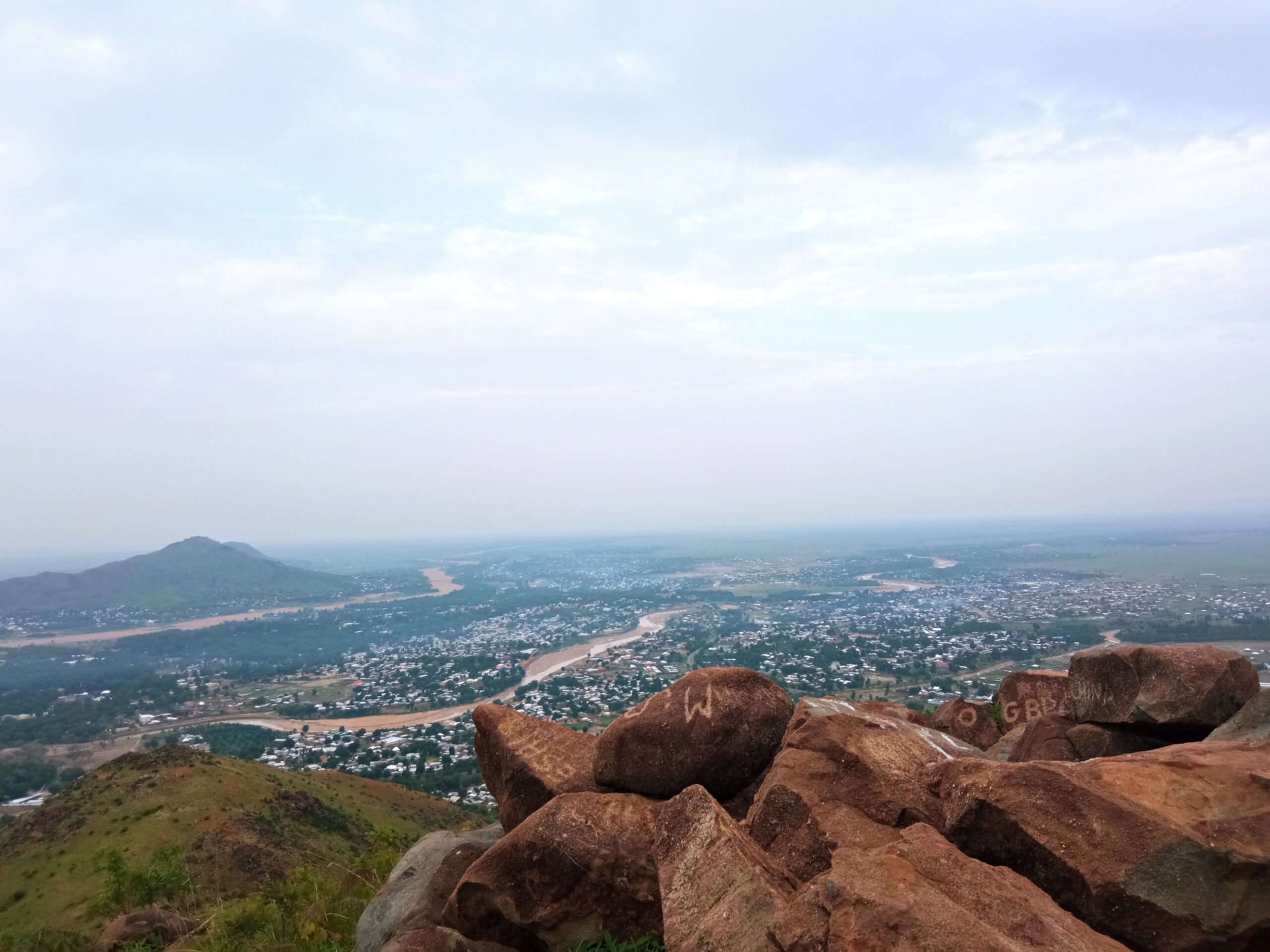
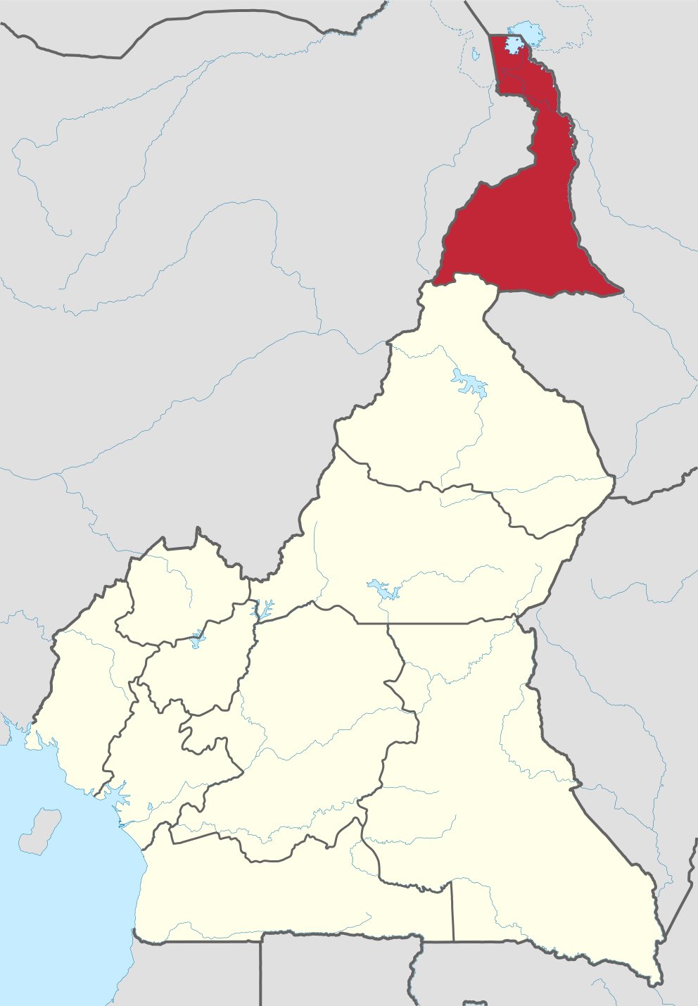
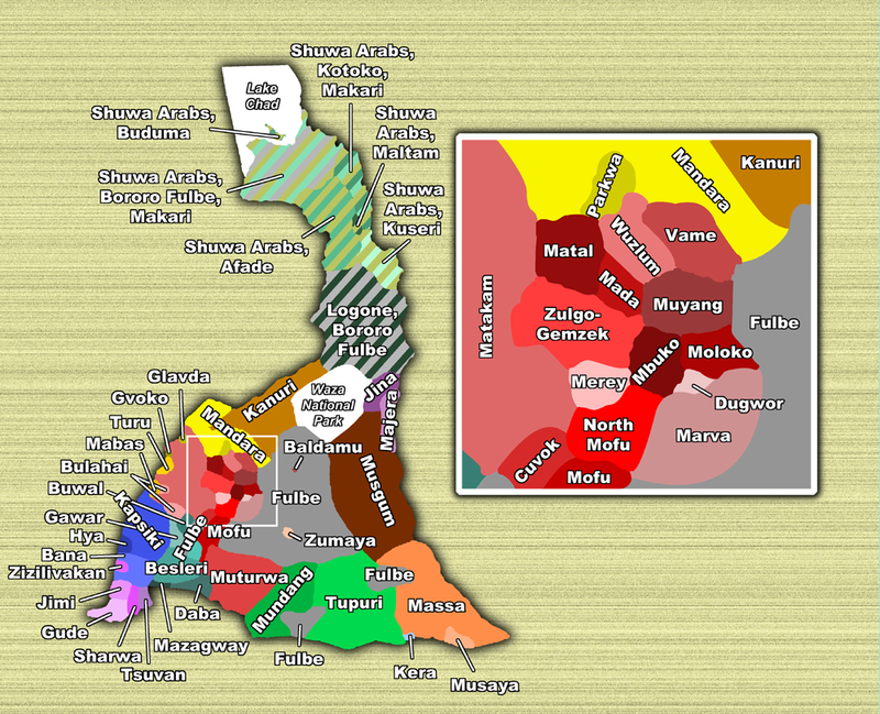
The Far North Region, also known as the Far North Region in English, is the Republic of Cameroon’s northernmost and most populous province. It is bordered by the Northern Region to the south, Chad to the east and Nigeria to the west. Its capital is Maroua. This region is notable for its great cultural diversity, home to more than 50 different ethnic groups, such as the Shuwa Arabs, Fulanis and Kapsiki. The inhabitants mainly speak Fulfulde, Chadian Arabic and French.
|
Location of Far North Region within Cameroon
|
|
| Coordinates: 11°00′N 14°30′E | |
| Country | Cameroon |
|---|---|
| Capital | Maroua |
| Divisions | Diamaré, Logone-et-Chari, Mayo-Danay, Mayo-Kani, Mayo-Sava, Mayo-Tsanaga |
| Government | |
| • Governor | Midjiyawa Bakary |
| Area | |
| • Total | 34,263 km2 (13,229 sq mi) |
| Population
(2015)
|
|
| • Total | 3,993,007 |
| • Density | 120/km2 (300/sq mi) |
Geography of the Far North Region


The geology of the Far North Region is mainly made up of sedimentary rocks such as alluvium, clay, limestone and sandstone. Rivers in the region, such as the Logone and Mayo Tsanaga, flow into Lake Chad to the north. To the south of the region, a band of granite separates the sedimentary zone from a zone of metamorphic rocks, including gneiss, mica and schists. The Rhumsiki Valley, a mountainous field dotted with extinct volcanoes, is a small area of volcanic rocks, such as trachyte and rhyolite.
The soils of the Far North Region are relatively complex. Much of the region is composed of young soils rich in raw minerals. This is particularly the case for the area south of Lake Chad and the Mandara Mountains on the western border of Nigeria. The soils of these regions are mainly black clays (alluvial soils). Seasonal variations between the region’s dry and wet seasons result in relatively shallow ferruginous soils.
A multitude of rivers cross the territory, many of which have their source in the Mandara Mountains. The Mayo Kébi, the Mayo Louti and their tributaries are part of the Niger River basin. The Louti has its source in the Mandaras, passes near the town of Kébi in the Northern Region, and then flows into western Chad. The other rivers in the region are part of the Lake Chad basin. The El Beid River flows from the Kalamaloué National Park and forms the northernmost part of the border between Cameroon and Nigeria. The Mayo Tsanaga has its source southwest of the El Beïd River and heads east, north of the Diamaré depression. The Logone has its source in the west of the territory and flows north, forming a large part of the border between the Far North and Chad. It finally flows into the Chari, which also has its source in Chad. The Chari forms the remainder of the border between Chad and Cameroon, before flowing into Lake Chad.
The Far North Region is also home to several lakes, the most famous of which is Lake Chad. This lake was formed by a tectonic depression which has since been filled by the region’s rivers. However, over time, these rivers also deposited sediment, which almost caused Lake Chad to disappear in the past. This situation is worrying, because when the Logone and the Mayo Kébi overflow, they join, thus diverting part of the water from the Logone to the Kébi, then finally to the Bénoué. Some scientists therefore predict that in the future, Lake Chad could lose one of its main sources of water. In addition to Lake Chad, the region has other lakes, such as Lake Fianga, which only exists during the rainy season, and Lake Maga, known for its fishing.
Climate of the Far North Region
The climate of the Far North Region is hot and dry. The region experiences a dry season and a wet season. The dry season lasts from November to April, with average temperatures ranging from 26°C to 32.4°C in January. The rainy season lasts from May to October. Annual rainfall ranges from 400 to 900 mm, with greater variations in the Mandara Mountains region. The region also experiences temperature variations depending on the seasons. For example, in Kousséri, there can be a temperature difference of 8.9°C between January and August.
Fauna and flora of the Far North Region
The Far North Region is home to a wide variety of wildlife, although their population has been reduced due to human activity and poaching. National parks such as Waza National Park, Kalamaloué National Park and Mozoko Gokoro National Park were created to protect the region’s flora and fauna. In these parks, one can observe emblematic species such as lions, elephants, giraffes, buffaloes and gazelles.
The vegetation of the Far North Region is mainly composed of savannahs, with fine grasses punctuated by thorny bushes such as baobab and shea. Areas with greater rainfall, such as the Mandara Mountains region and the south of the region, are home to thicker grasses and taller trees. The flood-prone areas of the Logone Valley and the periphery of Lake Chad are covered with tall grass. However, human activities such as deforestation, overgrazing and intensive cultivation have contributed to the desertification of the region. To combat this phenomenon, the Cameroonian government launched Operation Green Sahel, which aims to reintroduce trees into the region to restore vegetation.
Tourism in the Far North Region
The Far North Region offers many tourist opportunities. Hiking enthusiasts can explore the Mandara Mountains, including Mchigué Peak, which rises to an altitude of 1,224 meters. Fans of cultural tourism can visit the kingdoms and lamidats of the region, such as the kingdom of Oudjilla, the town of Pouss and the lunar landscape of Rhumsiki. Safari enthusiasts can head to the Waza, Kalamaloué and Mozoko Gokoro national parks, where they can observe various wildlife.
In conclusion, the Far North Region of Cameroon is a region rich in cultural diversity, natural beauty and tourism opportunities. Whether discovering the Mandara Mountains, exploring the kingdoms and lamidats of the region, or observing the flora and fauna in the national parks, this region offers a unique experience to visitors.
