Algeria
-
Algeria
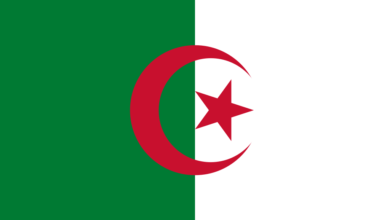
The National Flag of Algeria
The national flag of Algeria is comprised of two vertical bars, green and white, of equal width. Positioned at the centre is a red star and crescent, symbolizing Islam as the predominant faith of the nation. This flag was officially adopted on July 3, 1962, marking Algeria’s independence. The Algerian government utilised a comparable version in exile from 1958 to 1962. In heraldic terms, the Western description is “per pale…
-
National Anthems
Kassaman (Qassaman)
The national anthem of Algeria, known as “Kassaman” or “the oath,” holds deep significance for the Algerian people. It represents their struggle for independence and their unwavering commitment to their nation. In this article, we will delve into the history, lyrics, and cultural importance of Kassaman. History Kassaman’s origins can be traced back to the turbulent period of Algeria’s fight for independence from French colonial rule. The lyrics were written…
-
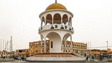
El Oued
El Oued is the principal town within the Souf Oases, located in the northeastern region of Algeria. Positioned approximately 50 miles (80 km) west of the Tunisian border, this town is situated in the northern Sahara. The Souf Oases, enveloped by the expansive sand dunes of the Grand Erg Oriental, stretch for 25 miles (40 km) from northwest to southeast. In the past, a river (oued) flowed to the east,…
-
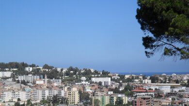
Jijel
Jijel, also known as Djidjelli during French colonial times, is a captivating port city in northeastern Algeria, gracing the Mediterranean coastline. It’s the capital of the Jijel Province and holds a rich history dating back to Phoenician times. Jijel’s past whispers through its ancient ruins and monuments. Explore the remnants of Phoenician tombs, delve into the Roman city of Igilgili, or witness the grandeur of the Ottoman-era citadel. Jijel map
-
Béchar
Located in western Algeria, Béchar is a town in the northern Sahara expanse, approximately 36 miles (58 km) south of the Moroccan border. The town derives its name from the nearby Mount Béchar, which reaches an elevation of 1,600 feet (488 meters). Béchar features a former European quarter with a military station and modern buildings, alongside a traditional quarter characterized by covered, narrow streets. Surrounded by date palm groves nourished…
-
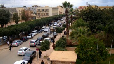
Batna
Batna is a beautiful city in northeastern Algeria, nestled against the Tellian Atlas Mountains. It’s the capital of Batna Province and boasts a rich history dating back to Roman times. Batna was founded as a Roman military outpost in the 1st century AD and named Lambèse. Remnants of the Roman era can still be seen in the city, such as the impressive ruins of the Lambèse Roman Theatre and the…
-
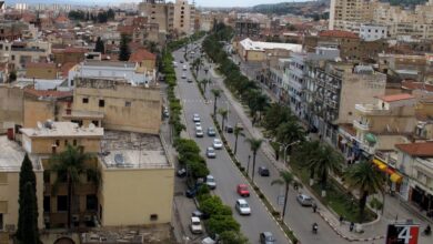
Chlef
Chlef (pronounced [ʃlɛf]) (in Arabic: الشلف, in Berber: ⵛⵛⵍⴼ), formerly known as Castellum Tingitanum in Roman times, then El Asnam (which means “the idols” in Arabic) and renamed Orléansville during the French colonial period, is an Algerian municipality located in the northern part of Algeria, in the wilaya (province) of the same name, where it serves as the capital. Chlef is situated halfway between Algiers, the capital, and Oran, the…
-
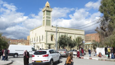
Djelfa
Djelfa is a city in the Ouled Nail Range in northern Algeria. It is the capital of Djelfa Province and is located in the Tell Atlas mountain range. The city is known for its historical and cultural significance, as well as its economic activities.
-
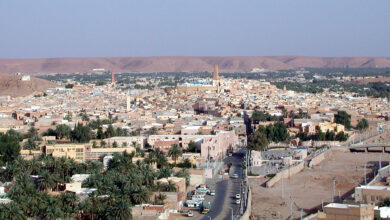
Ghardaia (Ghardaïa)
Ghardaïa is a city located in the Algerian Sahara Desert, approximately 600 km south of Algiers. It is the capital of the M’zab Valley, a region known for its five fortified cities, built in the 11th century by Ibadi Berbers.
-
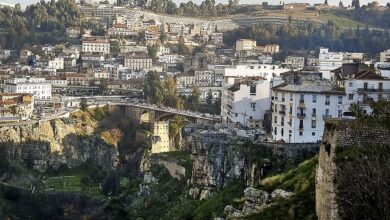
Constantine
Constantine (Arabic: قسنطينة Qusanṭīnah), also spelt Qacentina or Kasantina, is the capital of Constantine Province in northeastern Algeria. Constantine was named the Arab Capital of Culture in 2015. During Roman times it was called Cirta and was renamed “Constantina” in honour of emperor Constantine the Great. It was the capital of the French department of Constantine until 1962. Located somewhat inland, Constantine is about 80 kilometres (50 miles) from the Mediterranean coast, on the banks of…