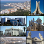
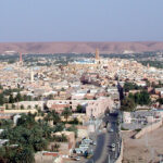
Béchar

Check Voyage info and Guide for Béchar Here

Check the weather in Béchar Here

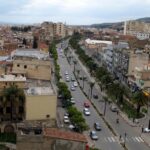
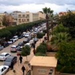
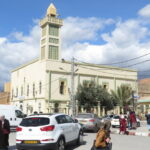
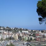
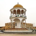
Located in western Algeria, Béchar is a town in the northern Sahara expanse, approximately 36 miles (58 km) south of the Moroccan border. The town derives its name from the nearby Mount Béchar, which reaches an elevation of 1,600 feet (488 meters). Béchar features a former European quarter with a military station and modern buildings, alongside a traditional quarter characterized by covered, narrow streets.

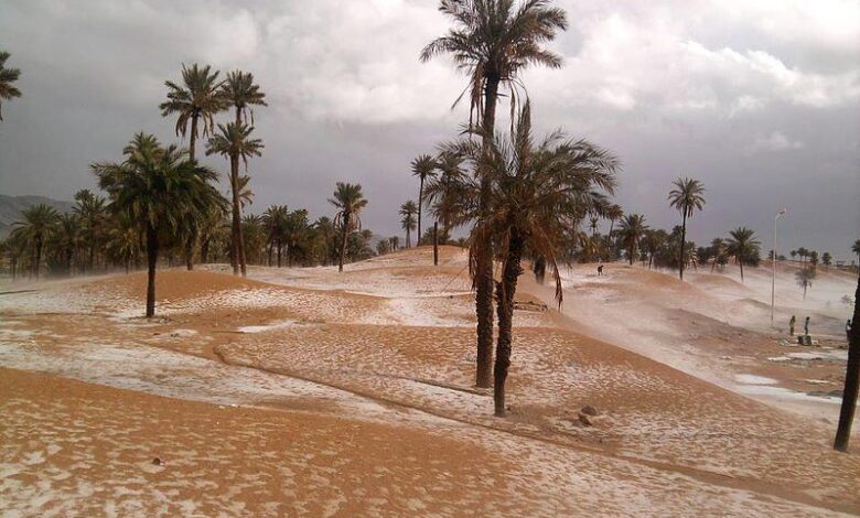
Surrounded by date palm groves nourished by the Wadi Béchar, the town is renowned for its expertise in leatherwork and jewellery. As a significant trade center at the crossroads of trans-Saharan roads, Béchar serves as the endpoint of a railroad originating from Oran in the south and boasts an airport. Additionally, Béchar Djedid (New Béchar), located 3 miles (5 km) to the south, was specifically constructed to accommodate the workforce employed in the nearby coalfields at Kenadsa.

ID
31298
Name
Béchar
State ID
1108
State Code
08
State Name
Béchar
Country ID
4
Country Code
DZ
Country Name
Algeria
Latitude
31.61667000
Longitude
-2.21667000
WikiData ID
Q638704

Béchar (Arabic: بشار) is the capital city of Béchar Province, Algeria. It is also a commune, coextensive with Béchar District, of Béchar Province. In 2008 the city had a population of 165,627, up from 134,954 in 1998, with an annual growth rate of 2.1%. The commune covers an area of 5,050 square kilometres (1,950 sq mi).

Béchar thrived on the activity of the coal mines until petroleum production seized the market.

Leatherwork and jewellery are notable products of Béchar. Dates, vegetables, figs, cereals and almonds are produced near Béchar. There are bituminous coal reserves near Béchar, but they are not exploited to their greatest potential because of transportation costs are too high relative to that from the oil and gas fields of eastern Algeria. The city was once the site of a French Foreign Legion post.

The Kenadsa longwave transmitter, whose masts are the tallest structures in Algeria at 357 metres (1,171 ft), is found near Béchar.

Geography

Béchar is located in the northwestern region of Algeria roughly 58 kilometres (36 mi) south of the Moroccan border.

Béchar lies at an elevation of 747 metres (2,451 ft) on the banks of Oued Béchar, which runs through the city from northeast to southwest. The rocky highlands of the Djebel Béchar overlook the city from the southeast, reaching 1,206 metres (3,957 ft) to the east of the city. Further to the northeast the Djebel Antar range rises even higher, to 1,953 metres (6,407 ft). The northwest, by contrast, is a flat rocky reg.

Climate

Béchar has a hot desert climate (Köppen climate classification BWh), with extremely hot summers and warm winters despite the high elevation. There is very little rain throughout the year, and summers are especially dry.

Economy

Agriculture is an important industry in Béchar. The commune has a total of 8,384 hectares (20,720 acres) of arable land, of which 5,100 hectares (13,000 acres) is irrigated. There are a total of 109,000 date palms planted in the commune, occupying 910 hectares (2,200 acres). Other crops include vegetables, figs, cereals and almonds. As of 2009 there were 19,067 sheep, 16,664 goats, 1,766 camels, and 444 cattle. There were also 126,000 chickens in 20 buildings.

There is some tourism in the city, with 10 hotels and tourist attractions including sand dunes, palm groves, the old ksar, and an ancient fort.

Other industries in the city include coal mining, and the production of leatherwork and jewellery.

Infrastructure and housing

98% of Béchar's population is connected to drinking water, 95% is connected to the sewerage system, and 99% (including 33,180 houses) have access to electricity. There are 6 fuel service stations in the town.

Béchar has a total of 33,245 houses, of which 25,499 are occupied, giving an occupation rate of 6.5 inhabitants per occupied building.

Transportation

The main road through Béchar is the N6 highway; it connects to Mecheria, Saida, Mascara and Oran to the north, and to Adrar and Timiaouine to the south. There is a total length of 207.5 kilometres (128.9 mi) of roads in the commune.

It is served by SNTF by a standard gauge railway converted in 2010 from narrow gauge (1,055mm). From 1941 to 1963 it was reached by the standard gauge Mediterranean-Niger-Railway.

Béchar is served by Boudghene Ben Ali Lotfi Airport, 4 kilometres (2.5 mi) to the northwest of the city.

Education

The city is home to the University of Béchar.

There are 68 elementary schools in Béchar, with 777 classrooms including 581 in use. There are a total of 33,511 school students.

8.3% of the population has a tertiary education, and another 23.0% has competed secondary education. The overall literacy rate is 86.4%, and is 91.4% among males and 81.4% among females.

Health

Béchar has 2 hospitals, 4 polyclinics, 17-room care facilities, a maternity ward, 36 private pharmacies, 5 medical operating theatres, and a psychiatric service.

Culture

Béchar has a cinema with 850 seats, as well as a museum.

Religion

Béchar has 27 operational mosques, with another 19 under construction.

Historical population

Localities

The commune is composed of 8 localities:

Béchar Djedid is located 5 kilometres (3 mi) south of the city and was constructed as housing for coal miners working in Kénadsa.

See also

  • Railway stations in Algeria

References

External links

  • Official website of Béchar Province

References


Discover


Powered by GetYourGuide

Subscribe to our Newsletter

Leave a Reply

Your email address will not be published. Required fields are marked *

Adblock Detected

Hello, Our system has detected that you are using Adblocker while acessing this website. Kindly disable it to support us.