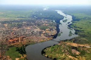
List of rivers in Cameroon
How may major rivers are there in Cameroon? Here, let us take a look at the list of rivers in Cameroon. Cameroon’s rivers are important for transportation, irrigation, and hydropower. They also support a diverse range of aquatic life, including fish, crocodiles, and hippos.
These rivers drain into four major basins: the Atlantic, Zaire/Congo, Niger, and Chad. The Sanaga is the longest river in Cameroon, at 515 kilometers (325 miles) long. The Wouri is the largest river, by volume, and is home to the port city of Douala.
Here is a list of rivers in Cameroon:
- Aïna River
- Benue River
- Campo River
- Dja River
- Kadéï River
- Lélé River
- Logone River
- Lokundje River
- Ndjim River
- Nkam River
- Noun River
- Nyong River
- Sanaga River
- Sangha River
- Wouri River
The Benue River
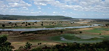
The Benue River, located in Africa, serves as a significant tributary to the Niger River, extending approximately 1,400 kilometers in length. During the summer months, people can navigate along the river for nearly its entire course, making it a crucial transportation route in the regions it traverses.
Originating in the Adamawa Plateau in northern Cameroon, the river flows westward, passing through the town of Garoua and the Lagdo Reservoir before entering Nigeria, just south of the Mandara Mountains. It continues its course through Jimeta, Ibi, and Makurdi before ultimately merging with the Niger River at Lokoja.
The Benue River boasts several substantial tributaries, including the Gongola River and the Mayo Kébbi, with additional contributors like the Taraba River and River Katsina Ala.
The Campo River
The Campo River, also known as the Ntem River, is a border river in Cameroon, mainland Equatorial Guinea, and Gabon. It rises in Gabon, and flows into the Atlantic Ocean in Cameroon in the Bight of Biafra. The river is about 460 kilometers long, and has a drainage basin of about 31,000 square kilometers.
This river is an important transportation route for the region, and is also used for fishing and hydroelectric power generation. The river is also home to a variety of biodiversity, including crocodiles, hippos, elephants, and gorillas.
It is also home to the Campo Ma’an National Park, which is one of the largest and most important rainforests in Central Africa. The park is home to a variety of wildlife, including elephants, gorillas, chimpanzees, and mandrills.
The Campo River region is a popular tourist destination, and visitors can enjoy a variety of activities, such as hiking, camping, fishing, and birdwatching.
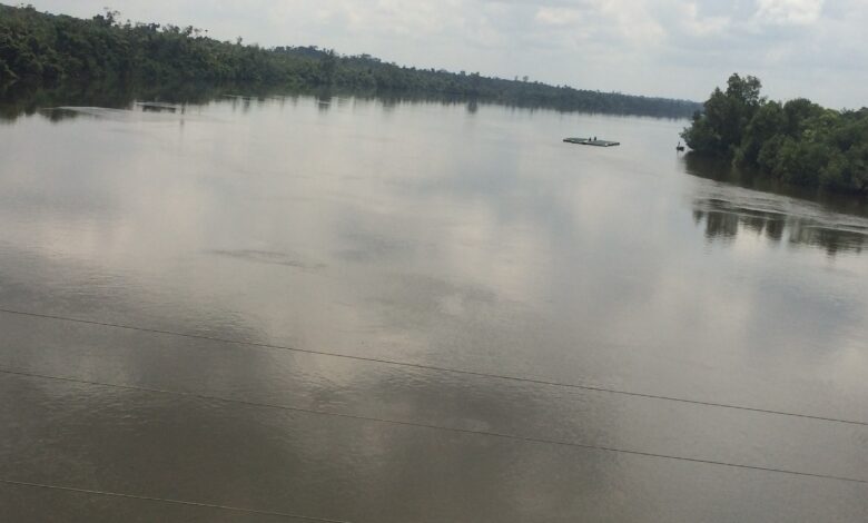
Wouri River
The Wouri River is a major river in Cameroon, Africa. It is formed by the confluence of the Nkam and Makombé rivers, and flows for about 160 km (99 mi) to the Wouri estuary at Douala, the chief port and industrial city in the southwestern part of Cameroon on the Gulf of Guinea. The river is navigable about 64 km (40 mi) upriver from Douala.
It is an important economic and transportation artery for Cameroon. It is used to transport goods and people between Douala and other cities in the interior of the country. The river is also a major source of drinking water for Douala and other nearby towns.
The Wouri River is also home to a variety of fish and wildlife, including crocodiles, hippos, and monkeys. The river is also a popular spot for fishing and birdwatching.
Here are some additional interesting facts about the Wouri River:
- It was named by the Portuguese explorer Fernão do Pó in 1472. He named the river “Rio dos Camarões” (River of Prawns) because of the abundance of prawns in the river. This name later evolved into the name of the country of Cameroon.
- The river is home to the largest hydroelectric power plant in Cameroon. The Song Loulou Dam, which is located on the Wouri River, generates about 40% of Cameroon’s electricity.
- It is also home to the Douala Port, which is the largest port in Cameroon. The port handles a wide variety of goods, including oil, timber, and bananas.
The river is an important part of the culture and economy of Cameroon. It is a vital transportation artery, a source of drinking water, and a popular spot for recreation.
Sanaga River
The Sanaga River is a river in Cameroon. It is the largest river in Cameroon, and the third largest river in Central Africa. The Sanaga River has a length of 1,000 kilometers (621 miles) and a drainage basin of 130,000 square kilometers (50,000 square miles). The Sanaga River rises in the Bamenda Highlands in the western part of Cameroon. It flows eastward through the central part of the country, and then turns south and empties into the Gulf of Guinea. The Sanaga River is a major source of water for irrigation, hydroelectric power, and transportation in Cameroon.
It is home to a variety of wildlife, including hippopotamuses, crocodiles, elephants, lions, and gorillas. The river is also a popular tourist destination, and is home to a number of resorts and lodges.
Logone River
The Logone River is a major tributary of the Chari River in central Africa. It flows through Chad and Cameroon, and forms part of the international border between the two countries. The Logone is formed by the confluence of the Mbéré and Vina rivers in northern Cameroon, and flows northwest for approximately 1,000 km to join the Chari River at N’Djamena, the capital of Chad.
It is a vital source of water for people and livestock in the region. It is also used for irrigation and transportation. The Logone Basin is home to a variety of fish and wildlife, including hippopotamuses, crocodiles, and elephants.
This river Basin is a wetland ecosystem that is important for biodiversity and flood control. The basin is home to a variety of plant species, including papyrus, reeds, and grasses. The wetlands also provide habitat for a variety of birds, fish, and other wildlife.
The Logone River is facing a number of challenges, including climate change, pollution, and overexploitation. Climate change is leading to more extreme weather events, such as droughts and floods, which can damage the river’s ecosystem. Pollution from agriculture and industry is also a problem. Overexploitation of the river’s water resources is leading to declining water levels and increased salinity.
Subscribe to our Newsletter
Read Also: