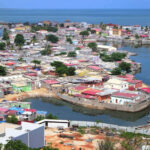
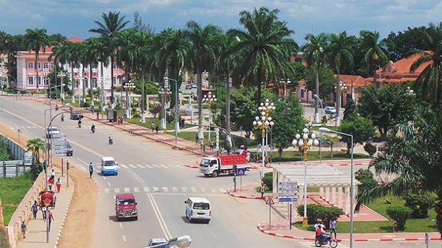
Malanje

Check Voyage info and Guide for Malanje Here

Check the weather in Malanje Here

Malanje, a town situated in north-central Angola, emerged in the mid-19th century as a significant open-air market on the country’s primary plateau, positioned between Luanda—now the nation’s capital, 250 miles (400 km) to the west—and the Cuango valley, inhabited by the Mbundu people, located 125 miles (200 km) to the east. Positioned at an elevation of 4,373 feet (1,333 meters), the town experiences a high-altitude tropical climate.

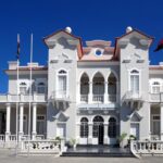
Before Angola gained independence from Portugal in 1975, Malanje’s surroundings were the primary cotton-producing area in the country. The departure of the Portuguese in conjunction with Angola’s independence and the subsequent civil war (1975–2002) significantly disrupted the production of cotton, as well as coffee and corn (maize). While Malanje suffered partial destruction during the civil war, reconstruction efforts were initiated in the years following the conflict.

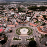
The encompassing region encompasses the well-watered northern slopes of Angola’s central plateau and is predominantly drained by the Cuanza River and its tributaries. This area is renowned for various attractions, including the 350-foot (107-meter) high Duque de Bragança Falls on the Lucala River, the Luando Game Reserve to the south, the Milando animal reserve to the north, and the Pungo Andongo stones—giant black monoliths intertwined with tribal legend. The majority of the region’s population belongs to the Mbundu ethnic group.

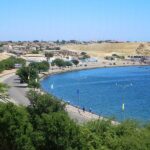
The principal economic activities in the area include livestock farming, primarily goats, and the cultivation of cotton, corn (maize), fruits, nuts, cassava (manioc), sisal, and tobacco. Additionally, the region boasts mineral resources such as manganese and gold. Quéssua Theological College is situated nearby, and Malanje serves as the terminus of the Luanda Railway, connecting it with the Atlantic coast.

Map view

More about Malanje 

ID
622
Name
Malanje
State ID
227
State Code
MAL
State Name
Malanje Province
Country ID
7
Country Code
AO
Country Name
Angola
Latitude
-9.54015000
Longitude
16.34096000
WikiData ID
Q621001

Malanje is the capital city of Malanje Province in Angola, with a population of 455,000 (2014 census), and a municipality, with a population of 506,847 (2014 census). Projected to be the thirteenth fastest growing city on the African continent between 2020 and 2025, with a 5.17% growth. It is located 380 kilometres (240 mi) east of Angola's capital Luanda. Near it are the spectacular Calandula waterfalls, the rock formations of Pungo Andongo, and the Capanda Dam. The climate is mainly humid, with average temperatures between 20 and 24 °C (68 and 75 °F) and rainfall 900 to 130 millimetres (35.4 to 5.1 in) in the rainy season (October to April).

History

Portuguese rule

Portuguese settlers founded Malanje in the 19th century. The construction of the railway from Luanda to Malanje, in the fertile highlands, started in 1885. The area around Malanje included Portuguese West Africa's primary areas dedicated to the production of cotton, the crop that drove its development since the beginning. The town developed in the mid-19th century as an important slave market created in 1852. Situated at an elevation of 1,134 metres (3,720 ft), the town has a high-altitude tropical climate, ideal to several agricultural productions. The city developed as an important agricultural, manufacturing, trading and services centre. Its productions included cotton, textiles, coffee, fruit and corn. The Cangandala National Park was established by the Portuguese authorities in 1970, having previously been classified as an Integral Natural Reserve in 1963.

After independence from Portugal

The withdrawal of the Portuguese in conjunction with Angola's independence in 1975, and, later, the Angolan Civil War (1975–2002), severely hampered the production of cotton as well as that of coffee and corn (maize). Malanje was partially destroyed during the civil war, but reconstruction efforts in the years following the end of the conflict have rebuilt the city and its surroundings.

Climate

Landmarks

Near the city is the Cangandala National Park, established by the Portuguese authorities on 25 June 1970, it was founded to protect the Giant Sable Antelope which were discovered in 1963. As far as religious buildings are concerned, there is the Evangelical Church at Quêssua and as for funerary constructions, the Tomb of the queen Ana de Sousa Nzinga Mbande and the tomb of José do Telhado, a local Robin Hood. José do Telhado was a Portuguese who was exiled to Portuguese Angola that in colonial days used to steal from rich whites and distribute to poor blacks. Worth visiting is the Forte de Cabatuquila in the city.

Transportation

Airport

Malanje Airport was built during the colonial era. Currently, there are no flights to the capital Luanda.

Railway

The construction of the railway from Luanda to Malanje, in the fertile highlands, started in 1885. After the end of the civil war in 2002, it was expected to be the terminus of a railway from the capital city and port of Luanda once reconstruction was complete.

See also

  • Transport in Angola

References

References


Discover


Powered by GetYourGuide

Subscribe to our Newsletter

Leave a Reply

Your email address will not be published. Required fields are marked *

Adblock Detected

Hello, Our system has detected that you are using Adblocker while acessing this website. Kindly disable it to support us.