Tema
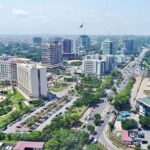
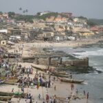
Located along the Gulf of Guinea in southeastern Ghana, Tema is a city and port situated 18 miles (29 km) east of Accra. Facing the Atlantic Ocean, this strategic location became crucial as, by 1950, existing ports such as Takoradi and Ghana’s older open-sea ports were inadequate for the nation’s growing international trade demands.
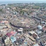
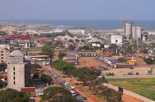
In response to this challenge, the construction of a second deepwater harbour was deemed necessary to specifically cater to the eastern part of the country and the Volta River basin. In 1951, Tema was selected due to its proximity to the Volta and Accra rivers, the availability of local construction materials for breakwaters, and its deep offshore waters that minimized the need for extensive dredging. The formal opening of Tema’s harbour took place in 1962, encompassing an impressive 410 acres (166 hectares) of sea, making it the largest man-made harbour in Africa.
The harbour infrastructure includes 3 miles (5 km) of breakwaters, 12 deepwater berths, an oil tanker berth, as well as a dockyard, warehouses, and transit sheds. Additionally, there is a dedicated fishing harbour located east of the lee breakwater, equipped with cold storage and marketing facilities.
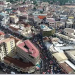
To support the development around the harbour, the government acquired 64 square miles (166 square km) of land north of Tema’s harbour, which was then entrusted to the Tema Development Corporation in 1952. The resulting “New Town” was meticulously planned as an industrial residential complex. Despite the influx of population in the 1960s due to new employment opportunities, the corporation faced challenges in constructing housing and providing essential services, leading to the development of a large slum area called Ashiaman near Tema. Efforts by the Tema Municipal Council to address this issue through building projects have been ongoing, yet the slum area persists. The population was recorded as 141,479 in 2000 and 139,784 in 2010.
Map view
More about Tema
| ID |
|---|
| 52211 |
| Name |
| Tema |
| State ID |
| 54 |
| State Code |
| AA |
| State Name |
| Greater Accra |
| Country ID |
| 83 |
| Country Code |
| GH |
| Country Name |
| Ghana |
| Latitude |
| 5.66980000 |
| Longitude |
| -0.01657000 |
| WikiData ID |
| Q726143 |