Atakpamé

Check Voyage info and Guide for Atakpamé Here

Check the weather in Atakpamé Here

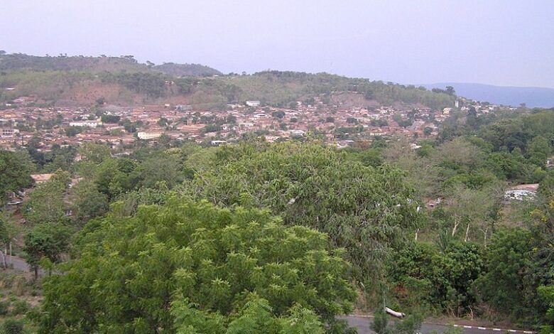
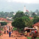
Atakpamé is a city in Togo, West Africa. It is the fifth largest city in the country, with a population of around 85,000 people. Atakpamé is located in the Plateaux Region, about 160 kilometres north of the capital, Lomé.

The city is an important agricultural and commercial center. It is known for its production of cotton, coffee, and cocoa. Atakpamé is also home to a textile factory and a brewery.

The city has a rich history. It was founded in the 19th century by the Ewe people. Atakpamé was an important stop on the caravan route between Lomé and the north. The city was also a haven for refugees fleeing from the Dahomey Kingdom.

Today, Atakpamé is a bustling city with a mix of traditional and modern architecture. The city is home to a number of markets, shops, and restaurants. Atakpamé is also a popular tourist destination, known for its friendly people and its beautiful setting.

Here are some of the things you can do in Atakpamé:

  • Visit the Grand Marché, the city’s main market.
  • Hike to the top of Mont Agou, the highest mountain in Togo.
  • Visit the ruins of Kamina, a former German military base.
  • Learn about the Ewe culture at the Musée National d’Atakpamé.
  • Attend the Odon-Itsu festival, a traditional yam festival held in July or August.

Map view

More about Atakpamé

ID
105159
Name
Atakpamé
State ID
2577
State Code
P
State Name
Plateaux Region
Country ID
220
Country Code
TG
Country Name
Togo
Latitude
7.53333000
Longitude
1.13333000
WikiData ID
Q126124

Atakpamé is the fifth largest city in Togo by population (84,979 inhabitants in 2006), located in the Plateaux Region of Togo. Cotton production was fostered in the are during German colonial rule.

History

The Oyo Empire controlled Atakpamé in the 1700s. Dahomey attacked Atakpamé during the reign of Adandozan. Atakpame was a major source of ivory in the 1870s.

In 1898, the Atakpamé district was established in Togoland and it was the last district established under German rule. Colonial Governor Hans Georg von Doering established a district office in Atakpamé that was similar to a manor from East Prussia. The Colonial Council attempted to boost cotton production in Atakpamé in 1900. Christian missionaries were barred from going north of Atakpamé in 1913.

Agbaba, despite being in the Krachi District, was administered from Atakpamé during French rule due to the similar languages in the areas.

It was during this campaign that Alhaji Grunshi fired the first shot by anyone in British service during the war. Most native residents of the city are the Ana subgroup of the Yoruba people.

Demographics

The Ewe language is spoken in Atakpamé. During German rule the area had a permanent Muslim population of 50.

Infrastructure

A railway between Atakpamé and Lomé was completed in 1911.

Climate

Atakpamé has a tropical savanna climate (Köppen Aw) characterised by a short dry season with the northeasterly harmattan trade winds from November to February and a lengthy though not intense wet season between March and October.

International relations

Twin towns — Sister cities

Atakpamé is twinned with:

Sources

  • Fage, J.D. and Roland Oliver (1975). The Cambridge History of Africa Volume 4 c. 1600 - c. 1790. Cambridge: Cambridge University Press. p. 811. ISBN 0-521-20981-1.

References

Works cited

References


Discover


Powered by GetYourGuide

Leave a Reply

Your email address will not be published. Required fields are marked *

Adblock Detected

Hello, Our system has detected that you are using Adblocker while acessing this website. Kindly disable it to support us.