Cameroon
-
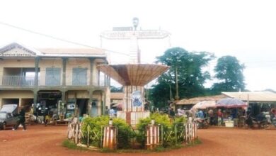
Bankim
Bankim is a town and commune in the Mayo-Banyo department of the Adamaoua region of Cameroon. It is located about 95 kilometres from Foumban and 125 kilometres from Banyo. The area’s vegetation is of shrub savanna type. Bankim is said to have been founded in 1395 by the local chief Kimi who founded the Tikar kingdom. Eldridge Mohammadou has given a date of 1760 to 1780 as the foundation date…
-
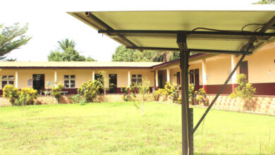
Nyamboya
Nyamboya is a village situated in the Bankim commune within the Adamawa region and Mayo-Banyo division of Cameroon. The residents of Nyamboya belong to the Kwanja ethnic group, who are believed to have migrated from Nigeria to establish their community in the Mayo-Banyo department. Country CameroonRegionAdamawaDivisionMay-BanyosubdivisionBankimDemographyPopulation189 methods. (2005 1 )GeographyContact details6° 17′ 05″ north, 11° 34′ 36″ east map Health Nyamboya Baptist Health Centre (NBHC) originated as a Primary Health Centre (PHC) in the 1990s…
-
National Anthems
The Rallying Song (Chant de Ralliement)
The national anthem of Cameroon is titled “Chant de Ralliement,” which translates to “The Rallying Song” in English. It’s also known as “Ô Cameroun berceau de nos ancêtres,” which means “O Cameroon, Cradle of our Forefathers.” It’s a powerful and moving anthem that speaks to the country’s rich history, diverse people, and aspirations for the future. There are two official versions of the anthem, one in French and one in…
-
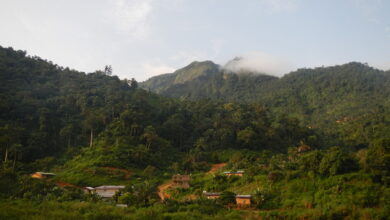
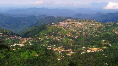
Wabane
Wabane is a municipality located in the Lebialem division of the Southwest Region in Cameroon. It was founded in 1988 and is situated in a mountainous area near the borders of the Southwest, Northwest, and West regions. The main ethnic group in Wabane is the Mundani people, and the principal economic activity is agriculture. Map History The history of Wabane dates back to the late 1980s when it was selected and named at the second…
-
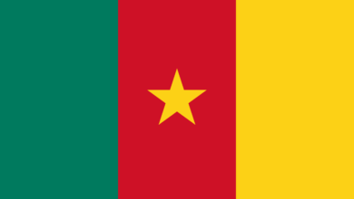
Cameroon
Download the Flag of Cameroon in SVG, PNG and WEBP
Download the Flag of Cameroon in SVG, PNG and WEBP. The current design of the Cameroon national flag, officially adopted on May 20, 1975, reflects the country’s transition to a unitary state. The flag features a vertical tricolour of green, red, and yellow, with a central yellow five-pointed star. The size of the central star varies, but it is consistently positioned within the inner stripe. Available flag images webp Flag…
-
Fontem
Fomtem is a village in the Lebialem Division of the South West region of Cameroon. It is also a sub-division and is located to the west of Dschang and Bafoussam. It constitute one of the three subdivisions of the Lebialem division and the inhabitants speak the Ngwe language. The people from Fontem and environs are called the Bnagwas, considered to be one of the Bamileke tribes. Alternative Names:FontemType:Populated place – a city, town,…
-
Abafum
Abafum is a village in the Ako commune of the Donga-Mantung division in the Northwest Region of Cameroon. It is also the seat of a 2nd degree traditional chiefdom. North-West’s capital Bamenda (Bamenda) is approximately 117 km / 73 mi away from Abafum. The distance from Abafum to Cameroon’s capital Yaounde (Yaoundé) is approximately 356 km / 221 mi. In 1970, 355 villagers lived in Abafum, mostly Mbembe. According to…
-

Ababita
Ababita is a locality in Cameroon. It is located in the Mvila Division of the South Region. Mvila is a department of South Province in Cameroon. The department covers an area of 8697 km2 and as of 2005 had a total population of 179,429. The division is further divided into the following councils; Biwong-Bane Biwong-Bulu Ebolowa (urban) Ebolowa (rural) Efoulan Mengong Mvangane Ngoulemakong The capital city of the South Region, Ebolowa (Ébolowa) is approximately 56…
-

Aanga
Aanga is a village/locality in the Upper Nyong division in the East Region of Cameroon. It is also the name of an intermittent watercourse (class H – hydrographic) in East Province (Cameroon (general)), Cameroon (Africa), with the region code Africa/Middle East. Aanga is located at an altitude of 717 meters. The geographic coordinates are 4°7’0″ N and 13°18’0″ E in DMS (degrees, minutes, seconds) or 4.11667 and 13.3 (in decimal degrees). The…
-
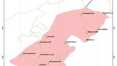
Alou
Alou is a town and commune in the South-West region of Cameroon. The Alou sub-division constitue one of the three sub-divisions (Alou, Wabane and Fontem) in the Lebialen division. This town/viallage got its name from the foggy nature of the climate, especially during the raining season. Alou in the Nweh language means “Fog”. Besides Alou itself, the urban area of Alou is divided into several districts such as Emollah, Kongho, Nwametaw,…