Cameroon
Cameroon is a country located in Central Africa and its capital city is Yaoundé. It is bordered by Nigeria to the west, Chad to the northeast, the Central African Republic to the east, Gabon and the Republic of Congo to the south, and Equatorial Guinea to the southwest. The country has a population of over 26 million people and its official languages are English and French. The country is divided into 10 regions, two of which are English-speaking regions.
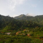
Cameroon has a diverse geography that includes rainforests, savannas, and mountainous regions. The country is known for its rich cultural heritage, which includes over 200 ethnic groups, each with its unique customs and traditions.
Cameroon gained its independence from France and the United Kingdom in 1960 and has since been a republic with a democratic government. The country’s economy is largely based on agriculture, with major exports including cocoa, coffee, and cotton. Cameroon also has significant oil reserves, which have helped to drive its economic growth in recent years.
It is believed to have been derived from the term “Rio dos Camarões,” meaning “River of Prawns” in Portuguese. This name was first used by Portuguese explorers in the 15th century to refer to the Wouri River, which flows through present-day Douala, Cameroon’s largest city and main port.
The name “Cameroon” was later used by German colonizers, who established the colony of Kamerun in the late 19th century. The name continued to be used after Cameroon gained independence from France and the United Kingdom in the 1960s.
It is worth noting that Cameroon has a rich linguistic heritage, with over 250 distinct languages spoken throughout the country. The official languages are English and French, which reflect the country’s colonial history, but many other languages are also widely spoken, including Fulfulde, Bamum, and Ewondo.
The region that is now Cameroon was home to a variety of ethnic groups and kingdoms, including the Tikar, Bamum, and Duala people, who had well-established trade routes with neighbouring regions. In the late 19th century, Cameroon became a German colony, known as Kamerun.
Following World War I, the Treaty of Versailles granted control of Cameroon to France and the United Kingdom as League of Nations mandates. Cameroon was divided into two parts: the larger, French-administered region in the east and the smaller, British-administered region in the west.
In the 1950s and 1960s, independence movements began to gain momentum, and Cameroon became independent from France in 1960, with Ahmadou Ahidjo serving as the country’s first president. The British-administered region in the west voted to join the newly independent Cameroon, and the country became a federal republic.
In 1982, Ahidjo resigned and was succeeded by Paul Biya, who remains in power today. Cameroon experienced economic growth and political stability in the early years of Biya’s presidency, but political repression, corruption, and economic challenges have persisted.
In recent years, Cameroon has faced security challenges, including the Boko Haram insurgency in the north and the separatist movement in the English-speaking regions of the country. The government has been criticized for its handling of these issues, and there have been calls for greater political reform and decentralization.
The Geography of Cameroon
The country has a coastline on the Atlantic Ocean and is bordered by Nigeria to the west, Chad to the northeast, the Central African Republic to the east, Gabon and the Republic of Congo to the south, and Equatorial Guinea to the southwest.
Cameroon’s geography is diverse, with a varied landscape that includes rainforests, savannas, highlands, and coastal plains. The country can be divided into four main geographical regions:
- Coastal plain: The coastal plain is a narrow strip of land that runs along the Atlantic Ocean. The region is characterized by sandy beaches, estuaries, and lagoons.
- Western Highlands: The western highlands consist of a series of volcanic mountains, including Mount Cameroon, which is the highest peak in West Africa. The region is known for its fertile soils, which support agriculture.
- Grassfields: The Grassfields region is located in the central part of the country and consists of rolling hills and grassy plains. The region is known for its traditional kingdoms and is home to many of Cameroon’s ethnic groups.
- Northern plain: The northern plain is a vast savanna region that borders Chad. The region is mostly flat and arid, with sparse vegetation and frequent droughts.
Cameroon is also home to several major rivers, including the Sanaga, which is the country’s longest river, and the Benue, which forms part of Cameroon’s northern border with Nigeria. The country has a tropical climate, with high temperatures and rainfall throughout much of the year.
Climate
Cameroon has a tropical climate, with high temperatures and humidity throughout much of the year. The country experiences two distinct seasons: a rainy season and a dry season.
The rainy season generally lasts from May to October and is characterized by heavy rainfall, particularly in the coastal regions and the western highlands. The amount of rainfall varies across the country, with some regions receiving as much as 4,000 mm of rain per year. The rainforest regions of Cameroon receive the highest amount of rainfall, while the northern regions are arider.
The dry season lasts from November to April and is characterized by hot, dry weather. Temperatures can reach up to 35°C in some parts of the country, particularly in the northern regions. The coastal regions are generally cooler than the inland regions due to the influence of sea breezes.
Cameroon is also affected by seasonal winds, including the Harmattan, which blows from the Sahara Desert during the dry season, and the Southwest Monsoon, which brings heavy rainfall to the coastal regions during the rainy season.
Overall, Cameroon’s climate is generally favourable for agriculture, with the country producing a variety of crops including cocoa, coffee, bananas, plantains, and cotton. However, climate change is becoming a growing concern in the country, with rising temperatures and changes in rainfall patterns threatening agriculture and natural resources.
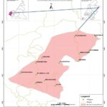
Map view
Economy and infrastructure in Cameroon
Agriculture is a key sector of the Cameroonian economy, accounting for about 20% of GDP and employing over half of the country’s workforce. The country is known for its production of cocoa, coffee, cotton, bananas, and rubber.
The mining industry in Cameroon is relatively underdeveloped, but the country has significant deposits of iron ore, bauxite, and gold. The oil and gas sector is a major contributor to the economy, with oil exports accounting for over 40% of total exports.
The service sector in Cameroon is growing, particularly in the areas of telecommunications and finance. Cameroon has a well-developed telecommunications network and is home to several international banks.
In terms of infrastructure, Cameroon has a relatively well-developed road network, particularly in the south of the country. However, the quality of roads in the north and west is generally poor, and transportation infrastructure in rural areas is limited. The country has several major ports, including the port of Douala, which is the largest in Central Africa.
Cameroon has made efforts to improve its energy infrastructure, with the development of hydroelectric power stations and investments in solar and wind power. However, access to electricity remains limited, particularly in rural areas.
Overall, Cameroon faces challenges in terms of infrastructure development and diversification of its economy beyond extractive industries. However, the country has made progress in recent years, and there are opportunities for growth in sectors such as agriculture, manufacturing, and services.
Education system
Cameroon’s education system is largely based on the French educational model, which emphasizes a strong academic curriculum and centralized control. The education system is overseen by the Ministry of Education, which is responsible for formulating policies, setting standards, and monitoring performance.
The system is divided into three main levels: primary education, secondary education, and tertiary education. Primary education is compulsory and lasts for six years. At the end of primary school, students take a national exam to determine if they can continue to secondary school.
Secondary education is divided into two cycles: the first cycle lasts four years and leads to the award of the BEPC (Brevet d’Etudes du Premier Cycle) for Francophones and the GCE Ordinary Level for English-speaking Cameroonains, while the second cycle lasts three years and leads to the award of the Baccalaureate (BAC) or GCE Advanced Level. The Baccalaureate is required for admission to tertiary institutions.
Tertiary education is provided by universities and other institutions of higher learning, both public and private. Cameroon has several universities, including the University of Yaoundé, the University of Douala, and the University of Bamenda, among others. The country also has several technical and vocational training institutions.
Cameroon’s education system faces several challenges, including inadequate funding, teacher shortages, and disparities in access and quality between urban and rural areas. However, the government has implemented several reforms in recent years to address these challenges and improve the quality and accessibility of education in the country.
Politics in Cameroon
Cameroon is a presidential republic with a multi-party system, but the country has been dominated by President Paul Biya and his ruling Cameroon People’s Democratic Movement (CPDM) party since the early 1980s.
Cameroon’s political system is characterized by a strong presidency, a relatively weak parliament, and a judiciary that is not independent of the executive branch. There have been allegations of election fraud and human rights abuses under Biya’s rule, and opposition parties have faced restrictions and harassment.
In recent years, Cameroon has faced security challenges, including the Boko Haram insurgency in the north and the separatist movement in the English-speaking regions of the country. The government has been criticized for its handling of these issues, and there have been calls for greater political reform and decentralization.
In 2019, Biya won a seventh term in office in an election that was marred by allegations of fraud and irregularities. The opposition boycotted the election, and international observers criticized the process as flawed.
The government has also been criticized for its treatment of political dissidents and journalists. In 2019, journalist Samuel Wazizi died in military custody after being arrested for his reporting on the conflict in the English-speaking regions. There have also been reports of torture and extrajudicial killings by security forces.
Overall, politics in Cameroon is characterized by a lack of transparency, limited political freedoms, and a concentration of power in the hands of the president and his allies.
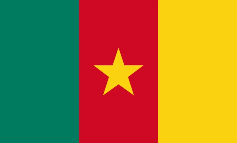
Cameroon Flags
Check all Cameroon flag images in PNG, SVG, webp and JPEG format here
National Anthem
The national anthem of Cameroon is titled “Chant de Ralliement,” which translates to “The Rallying Song” in English. It’s also known as “Ô Cameroun berceau de nos ancêtres,” which means “O Cameroon, Cradle of our Forefathers.” It’s a powerful and moving anthem that speaks to the country’s rich history, diverse people, and aspirations for the future.
Further reading
Towns, cities, and villages in Cameroon
Nkongsamba
Check Voyage info and Guide for Cameroon Here Check the weather in Cameroon Here Nkongsamba is a city in western Cameroon, located in the Moungo department, which is in the Littoral region. As of the 2005 Census, the city had…
Kumba
Check Voyage info and Guide for Cameroon Here Check the weather in Cameroon Here Nestled in the heart of the Meme department in the Southwest Region of Western Cameroon, the vibrant city of Kumba, colloquially known as “K-town,” stands as…
Fontem
Check Voyage info and Guide for Cameroon Here Check the weather in Cameroon Here Fomtem is a village in the Lebialem Division of the South West region of Cameroon. It is also a sub-division and is located to the west…
Nyamboya
Check Voyage info and Guide for Cameroon Here Check the weather in Cameroon Here Nyamboya is a village situated in the Bankim commune within the Adamawa region and Mayo-Banyo division of Cameroon. The residents of Nyamboya belong to the Kwanja…
Garoua
Check Voyage info and Guide for Cameroon Here Check the weather in Cameroon Here Garoua, also known as Garua or Garwa in Fula, is a port city and the capital of the North Region of Cameroon. It is located on…
Bafoussam
Check Voyage info and Guide for Cameroon Here Check the weather in Cameroon Here Bafoussam, situated in the Bamboutos Mountains, is the capital and largest city of the West Region of Cameroon. It is the third most financially significant city…
Abafum
Check Voyage info and Guide for Cameroon Here Check the weather in Cameroon Here Abafum is a village in the Ako commune of the Donga-Mantung division in the Northwest Region of Cameroon. It is also the seat of a 2nd…
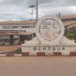
Bertoua
Check Voyage info and Guide for Cameroon Here Check the weather in Cameroon Here Bertoua is a city in the East Region of Cameroon. It is the capital of the Lom-et-Djerem department and the largest city in the region. Bertoua…
Ngaoundéré
Check Voyage info and Guide for Cameroon Here Check the weather in Cameroon Here Ngaoundéré, also known as N’Gaoundéré, is the capital of Cameroon’s Adamawa Region. It had a population of 152,700 in 2005, but according to the film “Les…
Bangem
Check Voyage info and Guide for Cameroon Here Check the weather in Cameroon Here Nestled halfway up Mount Muanenguba and surrounded by breathtaking natural beauty, Bangem is a hidden gem in the Kupe Muanenguba division of Cameroon. As the capital…
